|
Directions:
From Chicago area,
Take Route 55 South to St Louis.
From points in Eastern US, get yourself onto Route 70 West to St Louis
The property is about 3 hours from St Louis, MO
From St Louis, Continue West on Route 70 about an hour to
Kingdom City Exit, South on Highway 54
Go thru Jefferson City, Osage Beach and to the center of Camdenton on HWY 54.
...Or just Mapquest or GPS to Camdenton, MO (if you are coming from the West, Mapquest or GPS to Roach, MO 65787),
then pick up the below directions from Highway J:
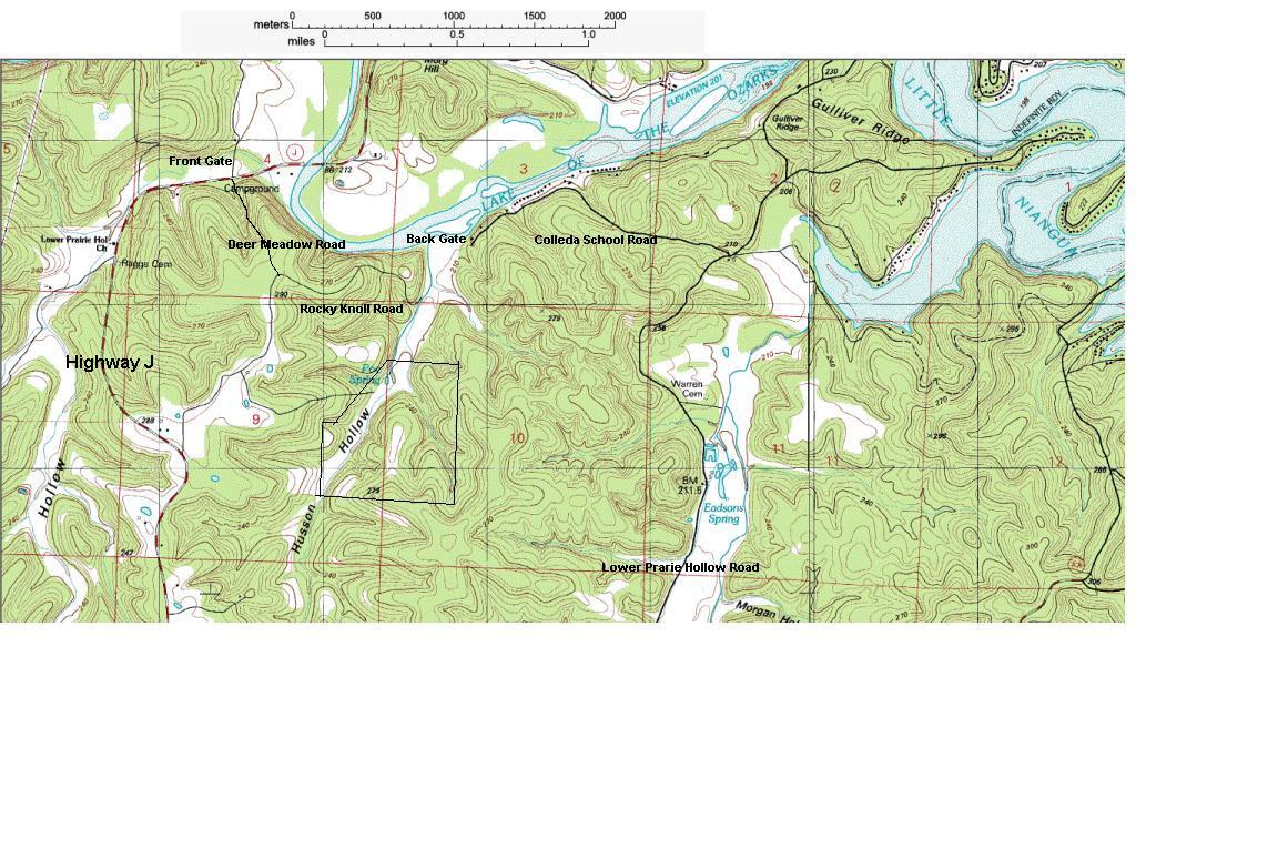
Directions from the center of Camdenton to our property (17.8 mi.) :
- On Highway 54 continue SouthWest through Camdenton, 8.9 miles,
- Turn Right on Highway J, drive 3.6 miles to the bridge.
- Immediately after the bridge,
- Turn right on Lower Prarie Hollow Road, drive 3.5 miles,
- Turn Left on Coelleda School Road, drive 1.2 miles to end of road.
- You are at our Back Gates, turn left to the red gate on Rivers End Road.
- Of the three gates you will see, ours is the furthest South, it is the middle red gate (furthest from the river/lake
which you can see to the North). Turn the combination lock to the code we provide if it is locked.
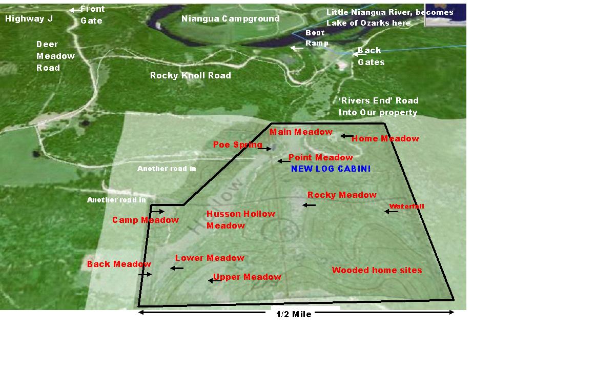
- You are on the road into our property (We named it 'Rivers End Road').
- Drive .6 mile, Bear right into the meadow, you are on the driveway of our cabin, and will see it there.
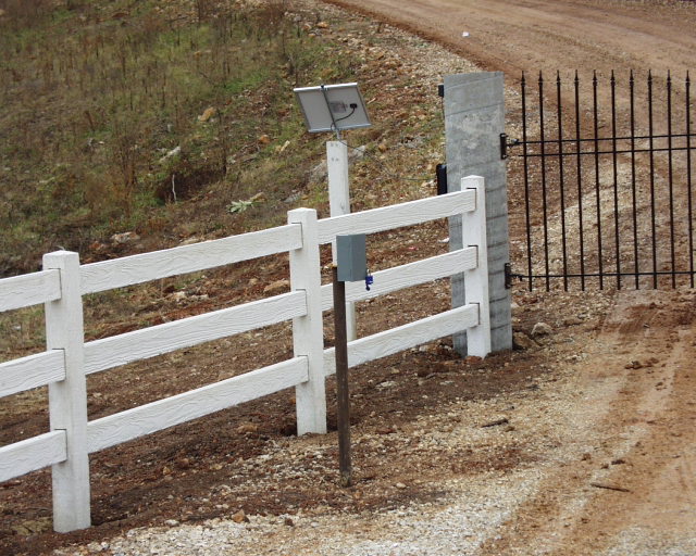
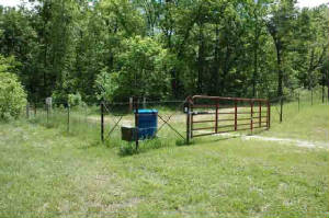
The keypad to open the front gate at highway J, is in the grey box on the black pole in the center of this picture.
Type in the code, and the gate opens. It will close automatically after a few minutes.
When leaving the property, the gate will sense your vehicle and open for you automatically.
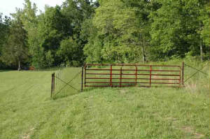
Back Gate to our land, on 'Rivers End Road' looking North
Back Gate to Rocky Knoll Road, the end of Colleda School Road. Looking East.
To the right is South, to the back gate to our land, just beyond this photo.
|